Floods Mapped.
·
Droughts Quantified.
Harvests Secured.
·
Climates Decoded.
Pioneering applied research and consulting in hydroinformatics, climate risk, and water systems.

Founder
MazKon HydroAnalytics
Dr. Sherly M. A. is a hydroinformatics and climate risk specialist with over 15 years of experience spanning academia, research, and industry. Her work integrates advanced geospatial analytics, statistical modelling, and machine learning to address complex challenges in flood risk, drought vulnerability, water resources management, and climate-smart agriculture.
She has contributed to nationally and internationally funded projects across India, the UK, Ireland, New Zealand, and Southeast Asia — working with institutions such as IIT Bombay, TERI School of Advanced Studies, Mott MacDonald, and Verisk Analytics.
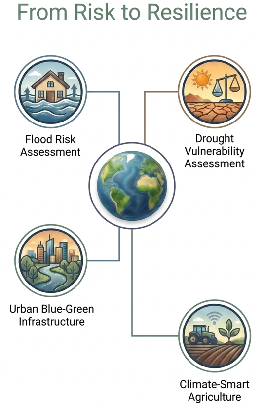
Technical solutions for institutions, consultancies, researchers, and development partners working on water, climate, agriculture, and disaster resilience.
Flood hazard mapping, exposure and vulnerability assessment, urban flood analytics, and risk-informed planning for resilient development.
Basin-scale water resources assessment, hydro-analytics, groundwater resource mapping, and decision-support planning using remote sensing and GIS workflows.
AI/ML-enabled agricultural decision support, irrigation planning, climate-resilient crop water management, and geospatial analytics for sustainable farming systems.
Drought risk analytics, vulnerability indexing, multivariate classification, and policy-ready reporting for regional and national planning.
Geospatial analytics, land use and land cover mapping, vegetation and landscape monitoring, satellite image interpretation, and GIS-based decision-support solutions
Urban stormwater resilience planning, nature-based solutions evaluation, blue-green infrastructure strategy, and climate adaptation support for cities and institutions.
Years of research & applied modelling
Peer-reviewed publications & conference papers
Research & industry projects across 5 countries
Projects in India, UK, Ireland, New Zealand & SE Asia
Selected consulting and applied work spanning flood risk, drought vulnerability, agricultural water management, climate resilience, and geospatial analytics.
Development of a climate risk dashboard integrating multi-hazard indicators, geospatial analytics, and decision-support visualisation for climate-resilient planning.
Assessment of eco-restoration and blue-green intervention impacts on flood mitigation, ecosystem services, and climate resilience.
Case study on water credits and impact-adjusted virtual water assessment for a beverage industry production unit.
Integrated assessment for Aravalli biodiversity park, Gurgaon, covering water and ecosystem service indicators.
Evaluation of blue-green infrastructure options for urban flood reduction and resilient planning.
District-scale integrated water resources management planning with a hydrologic and geospatial focus.
Used in-house flood modelling tools with ArcGIS, QGIS, R, and Python for regional hazard assessment.
Large-scale hazard modelling workflow for flood analytics and exposure-oriented outputs.
Rainfall and climate data analysis for risk-oriented interpretation under changing conditions.
Hydraulic modelling support for reservoir flood scenarios and dam breach risk studies.
Flood risk inputs for infrastructure planning and environmental assessment.
Flood modelling and risk analysis for catchment and local planning decisions.
Flood risk assessment in support of public-sector flood management objectives.
Flood hazard assessment for coastal and inland interaction zones.
Selected research output covering flood risk, drought vulnerability, water systems, climate analytics, and digital agriculture.
Dwivedi, S., Sherly, M.A. Multivariate assessment of digital agriculture and irrigation potential: Application to India. Agricultural Systems, 227.
Sherly, M.A., Chaudhuri, R.R., Tarannum, F., Vasudevan, P. and Bera, S. Interlinking Science-Policy for Stormwater Management using Urban Blue-Green Infrastructure: A Case Study of Gurugram District. Urban India.
Upadhyay, M. and Sherly, M.A. Multivariate Framework for Integrated Drought Vulnerability Assessment – An Application to India. International Journal of Disaster Risk Reduction, 85.
Yadav, V., Sherly, M.A., Ranjan, P., Prasad, V., Tinoco, R.O. and Laurent, A. Risk of plastics losses to the environment from Indian landfills. Resources, Conservation and Recycling, 187.
Bera, S., Sherly, M.A. and Janadri, K.K. Impact of COVID-19 on water and sanitation in Mumbai slums. Sustainability, Agri, Food and Environmental Research, 10(1).
Mohanty, M.P., Sherly, M.A., Ghosh, S. and Karmakar, S. Tide-rainfall flood quotient: an incisive measure of comprehending a region's response to storm-tide and pluvial flooding. Environmental Research Letters, 15(6).
Yadav, V., Sherly, M.A., Ranjan, P., Tinoco, R.O., Boldrin, A., Damgaard, A. and Laurent, A. Framework for quantifying environmental losses of plastics from landfills. Resources, Conservation and Recycling, 161.
Mohanty, M.P., Sherly, M.A., Karmakar, S. and Ghosh, S. Regionalized Design Rainfall Estimation: an Appraisal of Inundation Mapping for Flood Management Under Data-Scarce Situations. Water Resources Management, 32(14).
Sherly, M.A., Karmakar, S., Chan, T. and Rau, C. Design Rainfall Framework using Multivariate Parametric-Nonparametric Approach. Journal of Hydrologic Engineering, 21(1).
Sherly, M.A., Karmakar, S., Parthasarathy, D., Chan, T. and Rau, C. Disaster-Vulnerability Mapping for a Densely Populated Coastal Urban Area: An Application to Mumbai, India. Annals of the Association of American Geographers, 105(6).
Dwivedi, S. and Sherly, M.A. A Comprehensive AI/ML-Enabled Data Quality Framework for Climate-Smart Digital Agriculture. In Advances in Agri-Food Systems, Springer Nature.
Kansal, A., Sherly, M.A., Tarannum, F., Sarangi, G., Kumar, A. Water Credits: Impact-adjusted virtual water footprint to establish a baseline for the beverage industry.
Upadhyay, M. and Sherly, M.A. Analysis of Large Dam Storage Capacity and Its Effect on Water Demand Management in India. In Sustainable Water Resources Management, Springer Nature.
Karmakar, S., Sherly, M.A., Mohanty, M. Urban Flood Risk Mapping: A State-of-the-Art Review on Quantification, Current Practices, and Future Challenges. In Advances in Urban Design and Engineering, Springer Nature.
Vasudevan, P., Sherly, M.A., Chaudhuri, R.R. Hydrological Risk Assessment of the Coastal Megacity Chennai Using DRASTIC Method and SWAT. In Innovative Trends in Hydrological and Environmental Systems, Springer Nature.
Sharma, P., Sherly, M.A., et al. Rainfall-Induced Landslide Susceptibility Mapping of New Zealand Using Machine Learning. HYDRO 2025 International.
Sherly, M.A., et al. Developing a Multivariate Climate-Based Flood Risk Scoring Method for India. HYDRO 2024 International.
Dwivedi, S. and Sherly, M.A. A Novel Framework for Climate Regionalization using AI-Based Spatiotemporal Clustering Technique. HYDRO 2024 International.
Mukherjee, S., Sherly, M.A., et al. Semi-Automated Framework for Stream Gauge Datum Estimation Using Sentinel Imagery. HYDRO 2024 International.
Mothkuri, M., Sakamuri, G., Sherly, M.A., et al. Impacts of Climate Change on Rainfall and Flooding Events in Great Britain. World Environmental and Water Resources Congress 2024.
Dwivedi, S. and Sherly, M.A. GIS-based Mapping of Digital Agriculture Potential in India for Irrigation Water Management. IAEA Symposium, Vienna.
Upadhyay, M. and Sherly, M.A. Integrated Drought Vulnerability Index and Classification using Principal Component Analysis and Cluster Analysis – A Case Study of India. Global Water Congress 2020.
Sherly, M.A., Janadri, K.K. and Karmakar, S. Fuzzy cognitive mapping of flood risk perception and adaptive capacity of slum communities over the most flood-prone city in India. IMA 2019, Swansea University, UK.
Sherly, M.A., Karmakar, S., Chan, T. and Rau, C. A socio-technocratic approach to flood disasters in Mumbai City, India. EAUMEGA 2015, Paris.
Sherly, M.A., Karmakar, S., Chan, T. and Rau, C. Regional depth-duration-frequency curves for Mumbai City. ICWRER 2013, Koblenz, Germany.
Start a conversation on research collaboration, technical consultancy, training, or applied analytics solutions.
Phone: +91-8130584920
Cochin-683518, Kerala, India